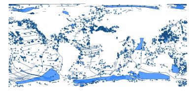
GEBCO Gazetteer of Undersea Feature Names
Names, generic feature types and geometries of seafloor features (seamounts, canyons, banks, ridges, basins, guyots, fracture zones, trenches ...) approved by the IHO-IOC GEBCO Sub-Committee on Undersea Feature Names (SCUFN), from the NOAA NCEI / IHO DCDB Undersea_Features feature service. The service has three layers, one per geometry type (2,632 points, 1,128 lines, 1,652 polygons), all kept here with the per-row geom_type (MultiPoint, MultiLineString or MultiPolygon) and component (point, line, polygon). FEATURE_ID, the gazetteer's permanent feature number, is the id: a feature that the service serves as both a point and an extent (101 do) keeps GEBCO:<FEATURE_ID> on its polygon (else line) and gets :point or :line on the other rows.
- Collection:
gebco_undersea v1.0.0, 5412 features, GeoParquet 1.1 (places.parquet) and PMTiles (places.pmtiles, layer gebco_undersea) - Licence: LicenseRef-IHO-IOC-GEBCO-Gazetteer - Attribution terms, no other restriction stated. ArcGIS item f09d579c68b84c5184fef1ac69ea7b24 licenseInfo and the GEBCO page ("Data set acknowledgement") both say: "Please include the following citation when data from the gazetteer are used or reproduced in reports, presentations and other products: IHO-IOC GEBCO Gazetteer of Undersea Feature Names, www.gebco.net". Item accessInformation: "IHO Data Centre for Digital Bathymetry (IHO DCDB); General Bathymetric Chart of the Oceans (GEBCO); NOAA National Centers for Environmental Information (NCEI)". No non-commercial or no-redistribution clause on either page. https://www.gebco.net/data-products/undersea-feature-names
- Attribution: IHO-IOC GEBCO Gazetteer of Undersea Feature Names, www.gebco.net. Served by the IHO Data Centre for Digital Bathymetry (IHO DCDB) and NOAA National Centers for Environmental Information (NCEI). Processed by Ocean Metrics.
- Refresh: monthly, by
.github/workflows/sync.yml (re-fetched only when the source's editingInfo.dataLastEditDate or record count changed)
Sources and provenance
Machine-readable copy: provenance.json (also in collection.json and the Parquet footer).
Schema
| Column | Type | Description |
|---|
| place_id | string | prefixed, unique id: GEBCO:<FEATURE_ID>; the point (or line) twin of a feature that also has an extent gets :point (or :line) |
| authority | string | GEBCO = IHO-IOC GEBCO Gazetteer of Undersea Feature Names |
| source_id | string | the gazetteer's FEATURE_ID (permanent feature number; shared by a feature's point, line and polygon rows) |
| name | string | official name followed by the generic term, e.g. 'Satsuma Seamount' |
| place_type | string | undersea_feature |
| geom_type | string | geometry type of this row: MultiPoint, MultiLineString or MultiPolygon |
| status | string | approved: the name is in the SCUFN gazetteer |
| status_source | string | URL that documents the status |
| status_date | string | ISO date (or year) the status took effect or was last confirmed; may be empty |
| source_url | string | the service endpoint or download the boundary was fetched from |
| source_date | date32[day] | date of the source's last data edit (retrieval date when the source serves none) |
| retrieved | timestamp[ms, tz=UTC] | UTC time the boundary was fetched |
| version | string | collection release version this row was built for |
| license | string | SPDX identifier of the licence (CC-PDDC = public-domain U.S. government work) |
| attribution | string | credit line to show with the data |
| component | string | source layer of the row: polygon (Polygon_Features), line (Line_Features) or point (Point_Features) |
| NAME_src | string | the gazetteer name without the generic term |
| TYPE | string | generic feature term (Seamount, Canyon, Bank, Ridge, ...); plural forms exist (Seamounts) |
| FEATURE_ID | int64 | gazetteer feature number; the id part of place_id |
| OBJECTID | int64 | native attribute of the source layer (OBJECTID) |
| Shape__Area | double | native attribute of the source layer (Shape__Area) |
| Shape__Length | double | native attribute of the source layer (Shape__Length) |
| bbox | struct<xmin: double, ymin: double, xmax: double, ymax: double> | GeoParquet bbox-covering column (xmin, ymin, xmax, ymax) |
| geometry | binary | WKB MultiPoint / MultiLineString / MultiPolygon, EPSG:4326, lines and polygons split at +/-180 antimeridian |
Native attributes keep the source layer's names; a native name equal to a gazetteer column ignoring case (NAME vs name) is suffixed _src.
Files
| File | Size | Checksum |
|---|
| places | 1.2 MB | 1220e62bae659ff3... |
| places-tiles | 6.1 MB | 1220576fdfe9461a... |
| styles/default | 2 kB | 12201eaf6504c35f... |
| provenance | 4 kB | 122034c30fd5fe29... |
| documentation | 0 kB | 1220e3b0c44298fc... |
Quick start
SELECT place_id, name, status, status_date
FROM read_parquet('https://storage.oceanmetrics.io/gazetteer/gebco_undersea/places.parquet')
ORDER BY place_id;
Changes